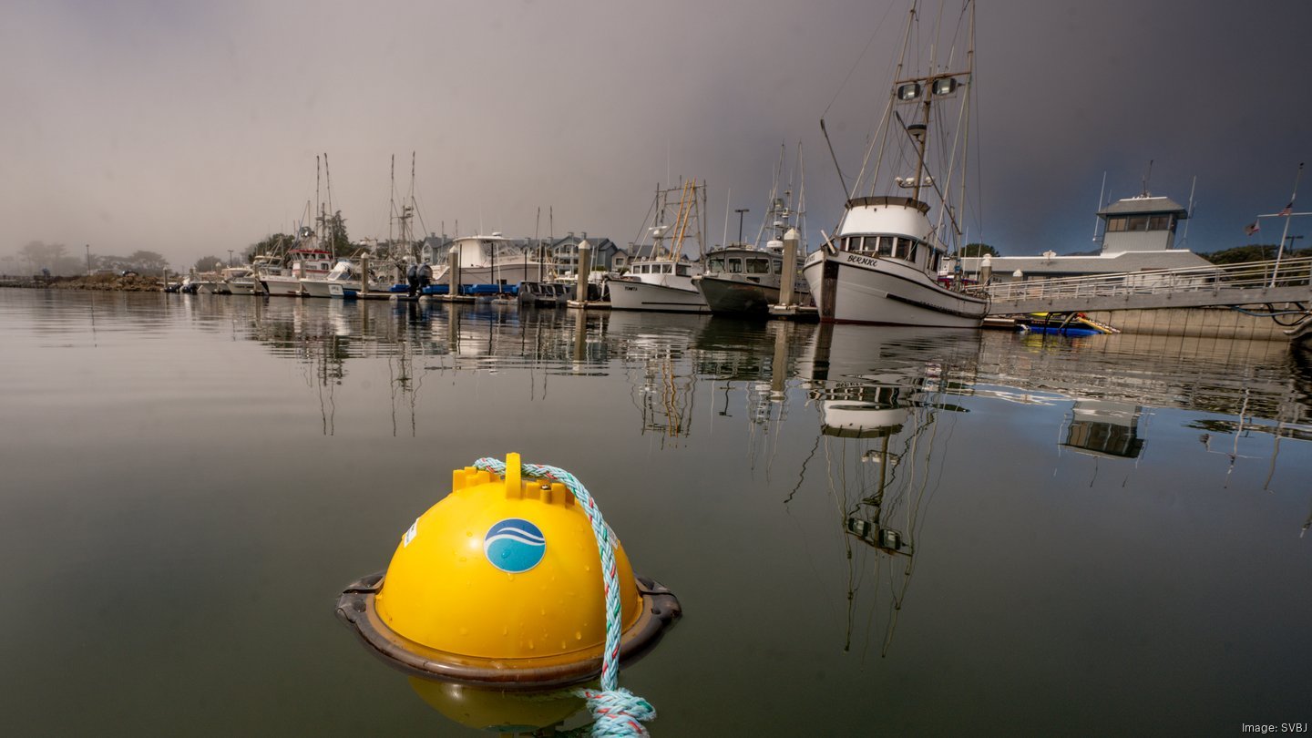
SMART BUOYS

Real time tracking for your deployed gear. Find gear faster, identify problems early, save time – fish smarter.

Our Solution

A yellow underwater drone with a blue logo, a transparent dome, and a blue and red rope on a metal grid surface.

Our intelligent, connected buoys provide you location and movement of any type of gear along with local conditions – anytime, anywhere.

A dark blue circular logo with a curved, incomplete circle and a small gap at the top, resembling a partial crescent shape.
Blue circular logo with a stylized crescent shape inside
Multiple rigged Smart Buoys stored in a bucket
Flowchart diagram showing an initial step, a decision point, and subsequent steps for a process.
Close-up of a black and white police badge with the number 161
A black and white illustration of a motherboard, showing various electronic components and connectors.

How it works

Satellite receiving data from Smart Buoy

Data is transmitted via satellite and radio

An upward trending blue arrow line graph on a black background.
Black background with a downward-pointing blue arrow.
Smart Buoy icon transmitting via Iridium satellite to cloud database
Icon of a cargo ship with boxes and a crane.
A person using a laptop at a desk with plants and papers
Icon of a computer monitor and a smartphone on a blue circular background.

Dual-band communication to both your vessel and
the cloud

Real time GPS enables rapid recovery

Track your gear via your plotter, mobile app or webpage


Fisheries

Icon of crab looking for a  Smart Buoy

Wild Capture Fisheries

High value fisheries globally

Offshore aquaculture kelp icon

Remote monitoring for farms

Aquaculture

North Atlantic Right Whale icon

Research

Asset tracking

Video Reviews

Customers tell their story